 Stage 2: Via the Salzsteig in the Volkzein
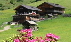
From Ausservillgraten to the Reiterstube
Walking time 8 hours - moderate hiking
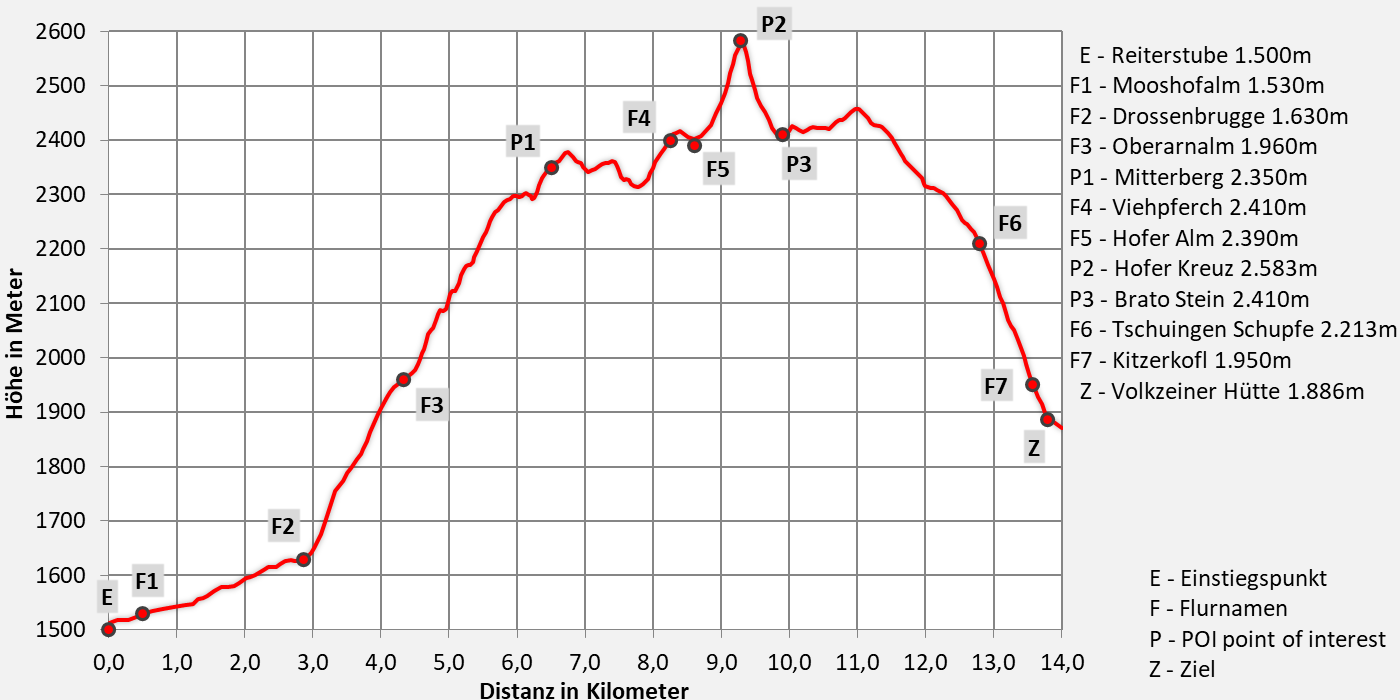
- 17,7km walking distance
- 1260 ascent altitude
- 1030 descent altitude
- lowest point: 1260m - Außervillgraten (Start)
- highest point: 2350m - Turn to Sommerwand-Köpfl
Follow old tracks
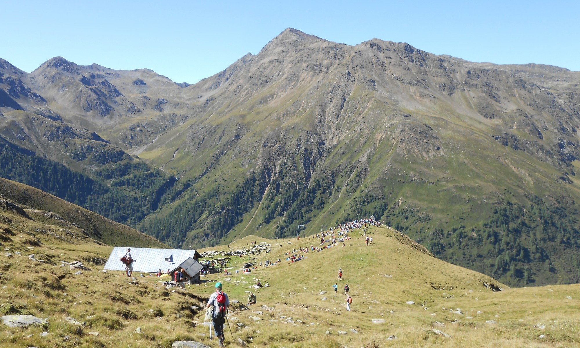
It hasn't always been as lonely here as it is today. We follow the Salzsteig trail in the Winkeltal valley, which leads up to 2.583 meters above the Villgrater Joch to Hopfgarten. We leave the high valley and climb back up via the Brunnalm to lofty heights to the Hofer Kreuz.
In between, spectacular views of Poseidon's Spear, the Sichelspitze, the Defereggen Valley, and the Kristeiner Valley reveal themselves. At some point, the summit cross of the Gölbner peak appears, and ancient stone-walled cattle pens tell of wild animals and of shepherds and their flocks who spent the summer here long ago. At the very top, views open up to the south and north, revealing the great mountains of the Eastern Alps, the Großvenediger, the Großglockner, and many more, in all their glory.
The trump card in the game is the summit of the Regenstein (2.891m).
Directions
From the Reiterstube, head up the valley on the left side, past the Mooshofalm (1.530m). Pass the Niederbruggeralm (1.600m) on the left bank of the stream until you reach the road again towards Volkzein. There, at the Brunneralm (1.630m), trail 58 points the way up. First you reach the Unterarnalm and then the Oberarnalm (1.960m). From the Oberen Arnkasern, the trail leads uphill to the Bodenhütte. Following trail no. 323, an old cattle track leads you up a moderately steep grassy slope, and after a short, boulder-covered valley, you reach the trail markers. At the trail marker, follow trail no. 23 to the Mitterberg and from there trail no. 24 to the Hoferalm. A little way after the Hoferalm, the trail points right up to the Villgrater Joch (2.583m) (Hofer Kreuz). From the Hofer Kreuz cross, the same descent follows, and a sign on a cairn points to the Volkzeiner Hut (No. 324). Following trail No. 324, we climb gently to a stone cattle pen and later to a shoulder of a slope. Behind it, a magnificent terraced area stretches out, leading us to the Leisacheralm. Descending through alpine pastures and meadows, we can already see the Volkzein pastures below in the valley, where we can stay overnight at the Volkzeiner Hut.

Download:
Trump variant
- additional climb to Regenstein auf 2891m
- moderate mountain tour - 9 hours walking time
- only for experienced climbers with rope safety on the descent from Regenstein towards Hofer Kreuz
- 14,4km walking distance
- 1460 ascent altitude
- 1100 descent altitude
- lowest point: 1.500m - Reiterstube (start)
- highest point: .28910m - Regenstein
This tour extension can also be extended to an alpine mountain tour with an ascent to the Regenstein (2.891 m). Follow the markings towards Regenstein. The descent from Regenstein towards Hofer Kreuz is only for experienced hikers; this section is secured twice with ropes (green).


Tourismusinformation Villgratental
+43 50 212 340
Jausenstation Reiterstube
+43 (0)4843 / 5188
im Juni Montags Ruhetag
ab Juli durchgehend geöffnet
12:00 - 19:00 Uhr
keine Übernachtungsmöglichkeit
Volkzeiner Hütte
+43 (0)4843 / 200 31
1. Juni bis 20. Oktober
Dienstag Ruhetag
12:00 - 19:00 Uhr
Übernachtung: ja
Hüttenwirt Toni Vollgger
seit 1987 Betreiber der Hütte
The legend of Pech Ziska
Even more godless and boisterous, however, was Pech Ziska. She, too, spent every summer as a dairymaid in the Volkzein. Once, in her hut, she prepared an alpine dance for High Women's Day (Assumption of Mary). The entire crowd of shepherds from the neighboring alpine pastures wanted to meet there. Doughnuts and schnapps were provided in abundance. When the dance was supposed to begin that evening, the musicians were still missing. As the young people were still impatient, Ziska called out: 'I've brought enough musicians; I'm in such a good mood today that I'd dance with the devil himself if he were here; but first I have to put away the holy water jug and turn over the holy images!' After this was done, Ziska grabbed a stick, went in front of the hut, struck the ground three times, and shouted: 'Music out!' Immediately we little men crawled out of the ground, ran into the living room, and coaxed wild melodies from their instruments. Dancing, yelling, and screaming began, which lasted until early morning. But when the Ave bell sounded from the village, a group of fiery little men attacked the dancers and dragged them away into the mountains. Ziska was the first to return around midday and went to work. From then on, however, she was feared as a witch and sorceress and avoided by everyone.