 Trail König of Herz-Ass Villgratental - Hochgrabe
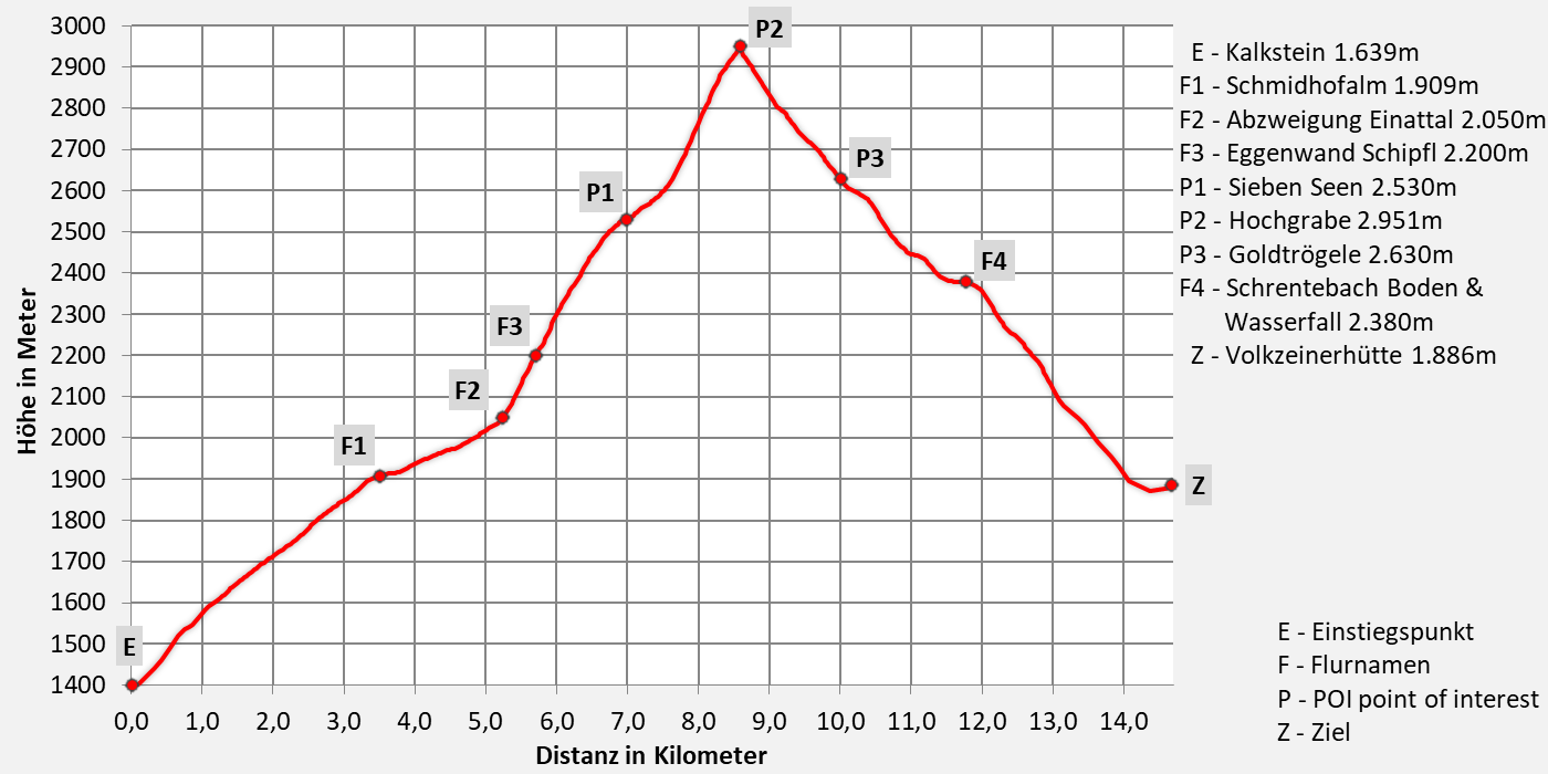
Transgression Hochgrabe from Innervillgraten to Volkzein (Außervillgraten)
Walking time 9 hours - moderate hiking, descent to Inner- or Außervillgraten possible.
- 15,0km walking distance
- 1620 ascent altitude
- 1130 descent altitude
- lowest point: 1.402m - Innervillgraten (start)
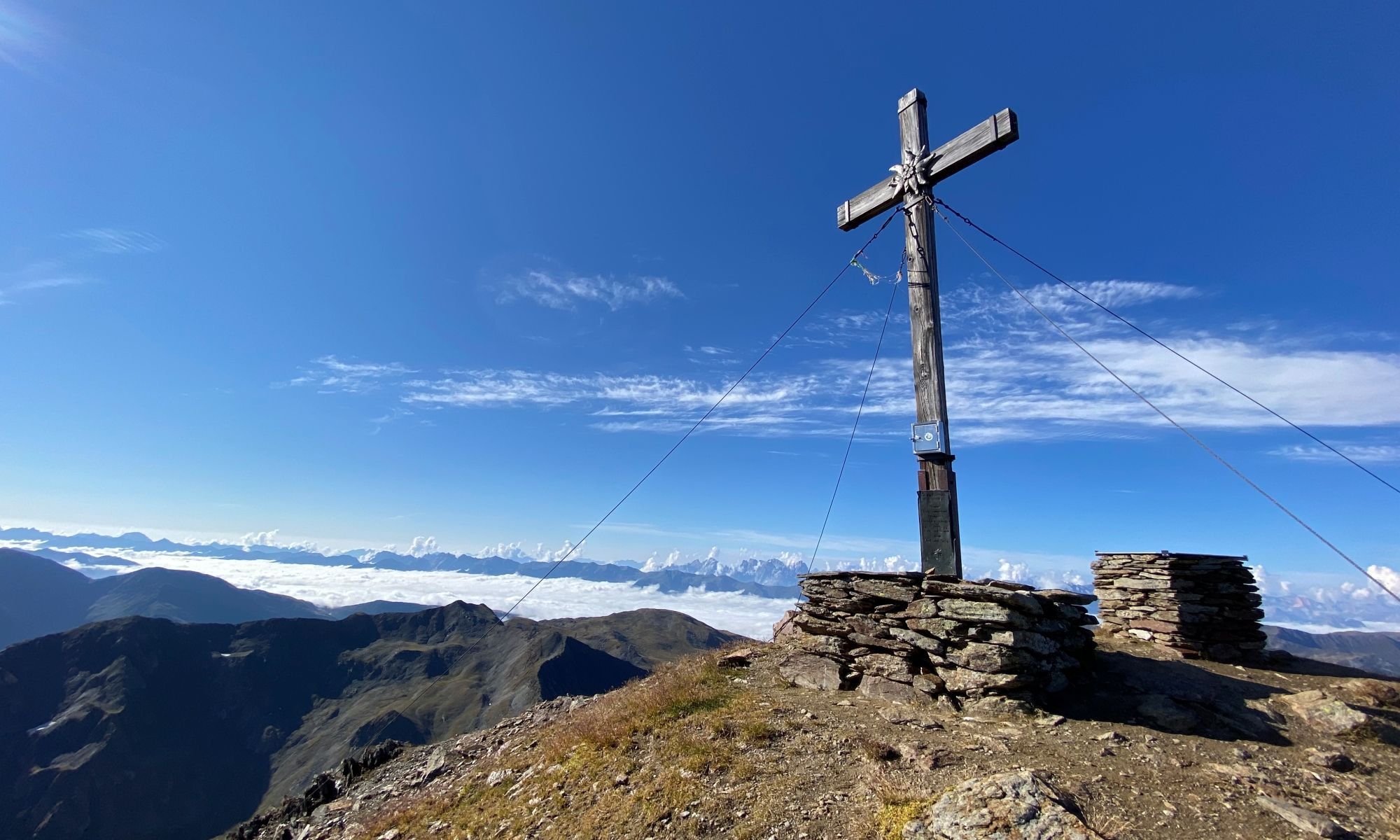
- highest point: 2.951m - Hochgrabe
Royal Route - to the Queen of the Villgraten Mountains
After a solitary climb through the Einattal Valley, past beautiful alpine huts, the trail climbs steeply to the Eggenwand Schipfl (2.200 m). The Seven Lakes are spread out at an altitude of 2.530 m. From there, the route continues over steep mountain flanks, later over the northeast ridge to the queen of the Villgraten Mountains – the Hochgrabe (2.951 m).
The descent takes us over the Wilden Platten, past the Goldtrögele (2.630 m) and to the Schrentebach Boden (2.380 m). The Schrentebach stream plunges steeply over a rocky ledge into the Heinkar cirque. A beautiful descent leads us out of the valley to the Volkzeiner Hut (1.886 m).
Download:


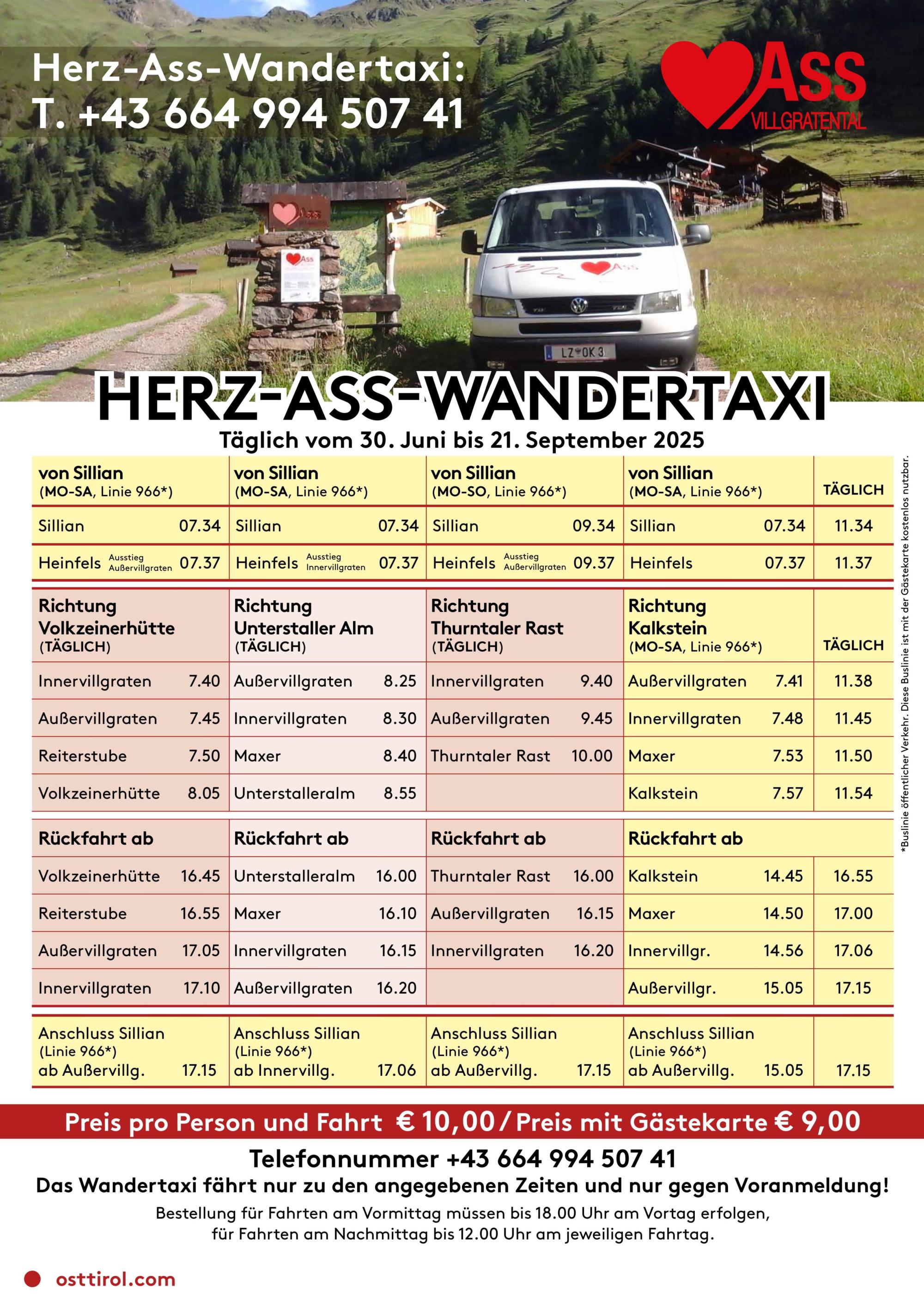
Tourismusinformation Villgratental
+43 50 212 340
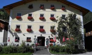
Gasthof Raiffeisen
+43 4843 5318
Übernachtung: ja
Gasthof Bachmann
+43 4843 5307
01.06.2025 - 20.10.2025
12.00 - 13.30 & 17.30 - 20.00 Uhr
Übernachtung: ja
Alfonsstüberl
+43.4843.5319
Übernachtung: ja
Gannerhof
+43 4843 5240
Übernachtung: ja
Volkzeiner Hütte
+43 (0)4843 / 200 31
1. Juni bis 20. Oktober
Dienstag Ruhetag
12:00 - 19:00 Uhr
Übernachtung: ja
Hüttenwirt Toni Vollgger
seit 1987 Betreiber der Hütte