 Stage 3: Path of springs and water
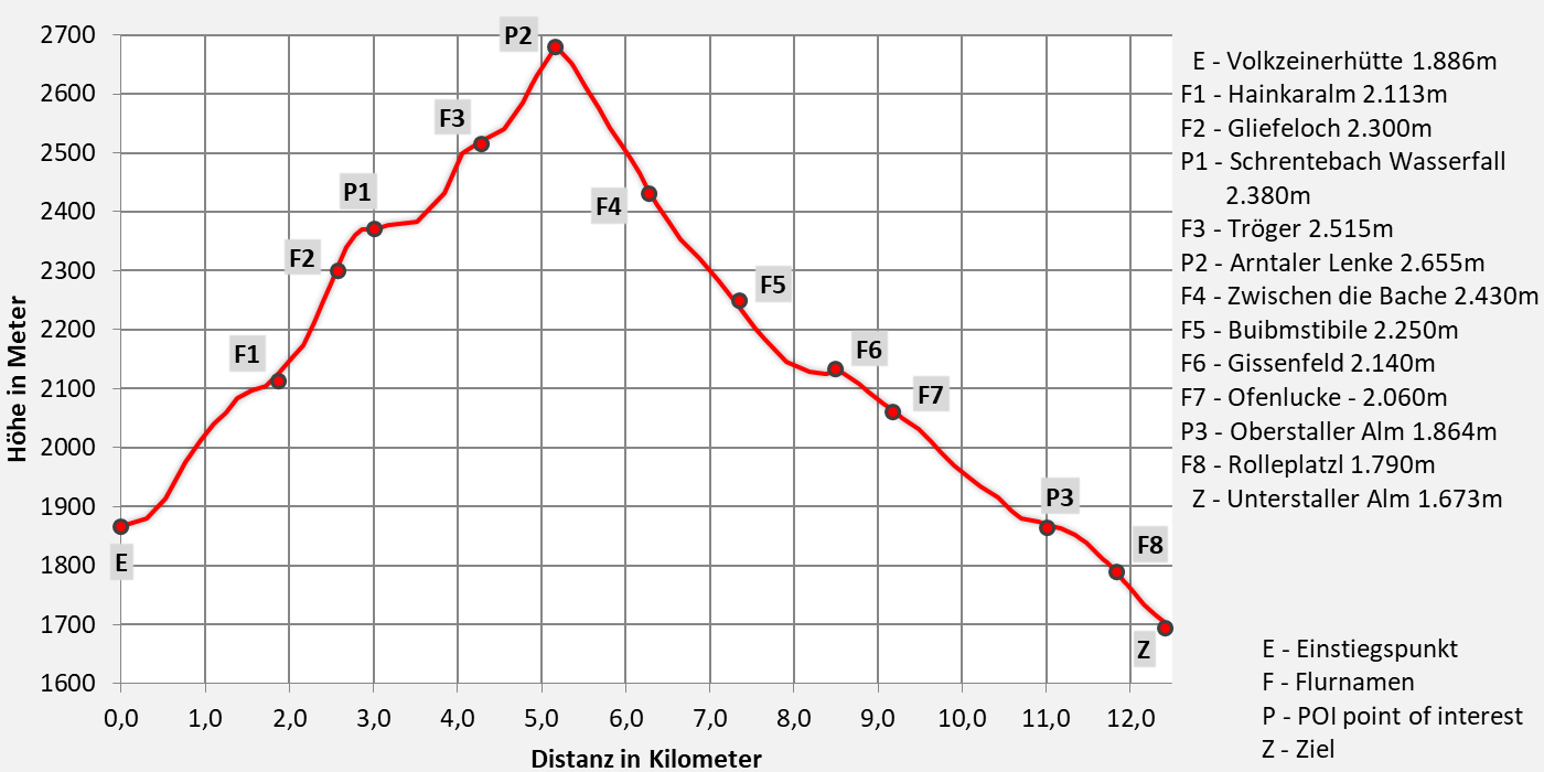
From the Volkzeiner Hut in Winkeltal to Unterstalleralm in Arntal
Walking time approx. 6 hours - moderate hike
- 12,6km walking distance
- 830 ascent altitude
- 1000 descent altitude
- lowest point: 1.673m - Unterstaller Alm (goal)
- highest point: 2.680m - above Arntaler-Lenke 2.655m
On the way to the source or “of troughs, troughs and horns!
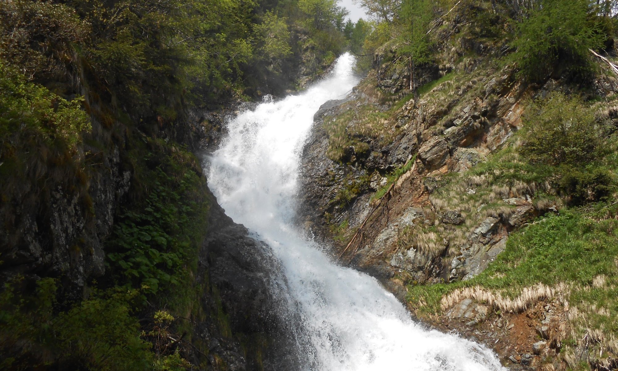
Our first destination on this stage is the legendary Schrentebachboden, an alpine pasture and spring landscape at approximately 2.380 meters above sea level, where a roaring mountain stream has its spectacular origins. On the way over the Arntaler Lenke, you should take a short detour to the legendary Goldtrögele at 2.630 meters and the Degensee (2,720 meters).
At Lenke, a completely new view opens up, the Dolomites appear timidly for the first time and in the north the Großglockner bids us farewell.
The trump card in the game is the Grosse Degenhorn (2.946 m).
Description
Our hike begins at the Volkzeiner Hut (1,886 m). We follow the alpine path to the Raineralm, then on to the Heinkaralm (approx. 2,100 m). From here, follow trail no. 19 (Tyrolean Jubilee Trail) past the waterfall to the Schrentebachboden (approx. 2,380 m) – a wild, mossy meadowland between rock and water. From this high valley terrace, past the barren remains of a former shepherd's hut, we climb a rocky grassy ridge and, keeping slightly left, reach a green cirque floor with an elongated pool (approx. 2,580 m) nestled between grassy ridges, the so-called Tröger (from here, a path branches off to the Falkamsee, approx. 20 minutes, which is always a worthwhile destination and invites you to take a rest). Follow trail no. 326 eastward through a flat trough valley and through countless streams, later climbing over rocks to the Arntaler Lenke (Volkzeinerlenke, 2,655 m). From here, we have a beautiful view of the Winkeltal valley, and before us lies the Arntal valley, where we descend, following trail no. 326, to Beim Garten. From there, the alpine path continues through a sparse larch forest and alpine roses (Zetten) directly alongside the steep rock faces of the almost 3,000-meter-high Rotspitze (2,956 m) and the Weißspitze, the highest peak in the Villgrater Joch Hochpustertal (2,962 m), the kings of our mountain range, to the picturesque alpine village of Oberstalleralm. From the alpine pasture, we follow the paved mountain road down to the Unterstalleralm, where we can stay overnight at the Gutwenger alpine hut. Or you can continue to Schwarzsee and spend the night in the bivouac hut.
Download:
Trump variant
- additional climb to Großes Degenhorn 2.946m
- difficult mountain tour - 8 hours walking time
- 12,4km walking distance
- 1075 ascent altitude
- 1250 descent altitude
- lowest point: 1.673m - Unterstaller Alm (goal)
- highest point: 2.946m - Großes Degenhorn


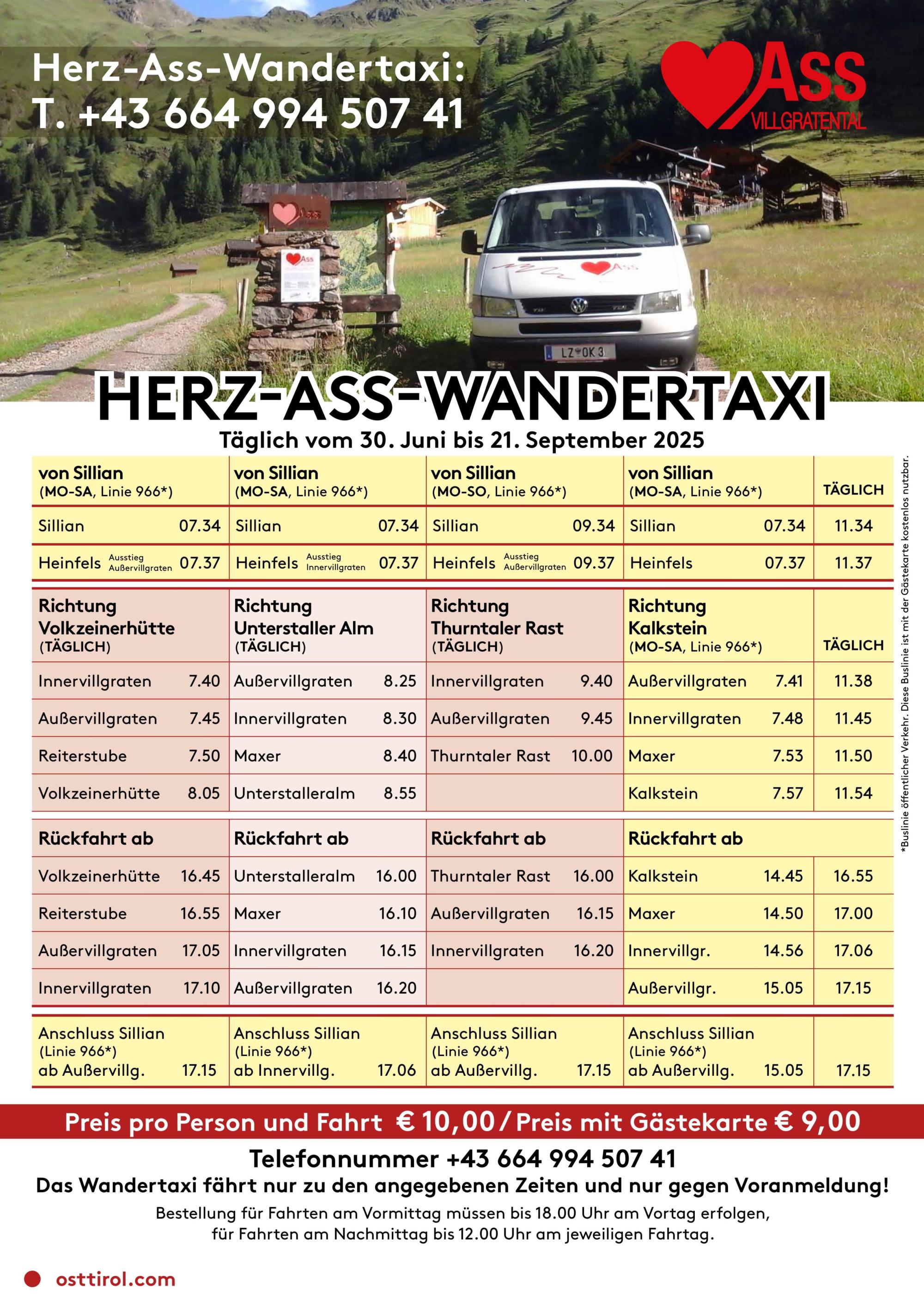
Tourismusinformation Villgratental
+43 50 212 340
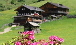
Volkzeiner Hütte
+43 (0)4843 / 200 31
1. Juni bis 20. Oktober
Dienstag Ruhetag
12:00 - 19:00 Uhr
Übernachtung: ja
Hüttenwirt Toni Vollgger
seit 1987 Betreiber der Hütte
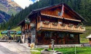
Unterstaller Alm
01.07.2025 - 26.10.2025
keine Übernachtungsmöglichkeit
asphaltierte Mautstraße
The Legend of the Gold Trough
In the Winkeltal, in the farthest corner of the Villgratental, lies the northern flank of the Hochgrabe (where the valley's last glacier was located), also known as the Wilde Platten (Wild Slabs). A shepherd was there in beautiful weather, on his way to look out for his cattle. He walked this path often. On his way, he noticed a stone slab leaning against a rock, which, after looking at it for a while and out of curiosity, he decided to roll away from the rock. He finally managed to do this after some effort, and after rolling it away, he took a few steps back in astonishment. In front of him lay a stone slab with a chalice carved into the inside. Approaching slowly, he looked into a small trough filled with gold. Everything shone in the sunlight, including the entire surrounding area. He stood motionless in front of the trough for a long time. The shepherd had memorized everything and carefully covered up the spot where he had found it. But he left a mark for himself so that he could find the spot again and no one else would discover it. He then happily returned to his alpine pasture with his secret across the wide valleys of the Schrentebach stream. The chalice, he learned, was the symbol of the Innichen lordship. The shepherd could hardly wait to return to the place where he had found it. When the moment and time were right again and he had the opportunity to come to this area, he could no longer find the spot, even though he had memorized the location well. No matter how hard he searched, the gold trough remained hidden.
The Goldtrögele (Gold Trough) in the Wilde Platten (Wilde Plateau) at an elevation of 2,650 meters appears to have been constructed as early as 1500. It is evidently a beech wedge carving. The trough is at ground level, 1.55 meters long, 86 centimeters wide, and 3 meters deep. Water fills the grave-like shaft halfway to a depth of 1.1 meters. At the bottom is a square alluvial hole.