 Trail Ober of Herz-Ass Villgratental
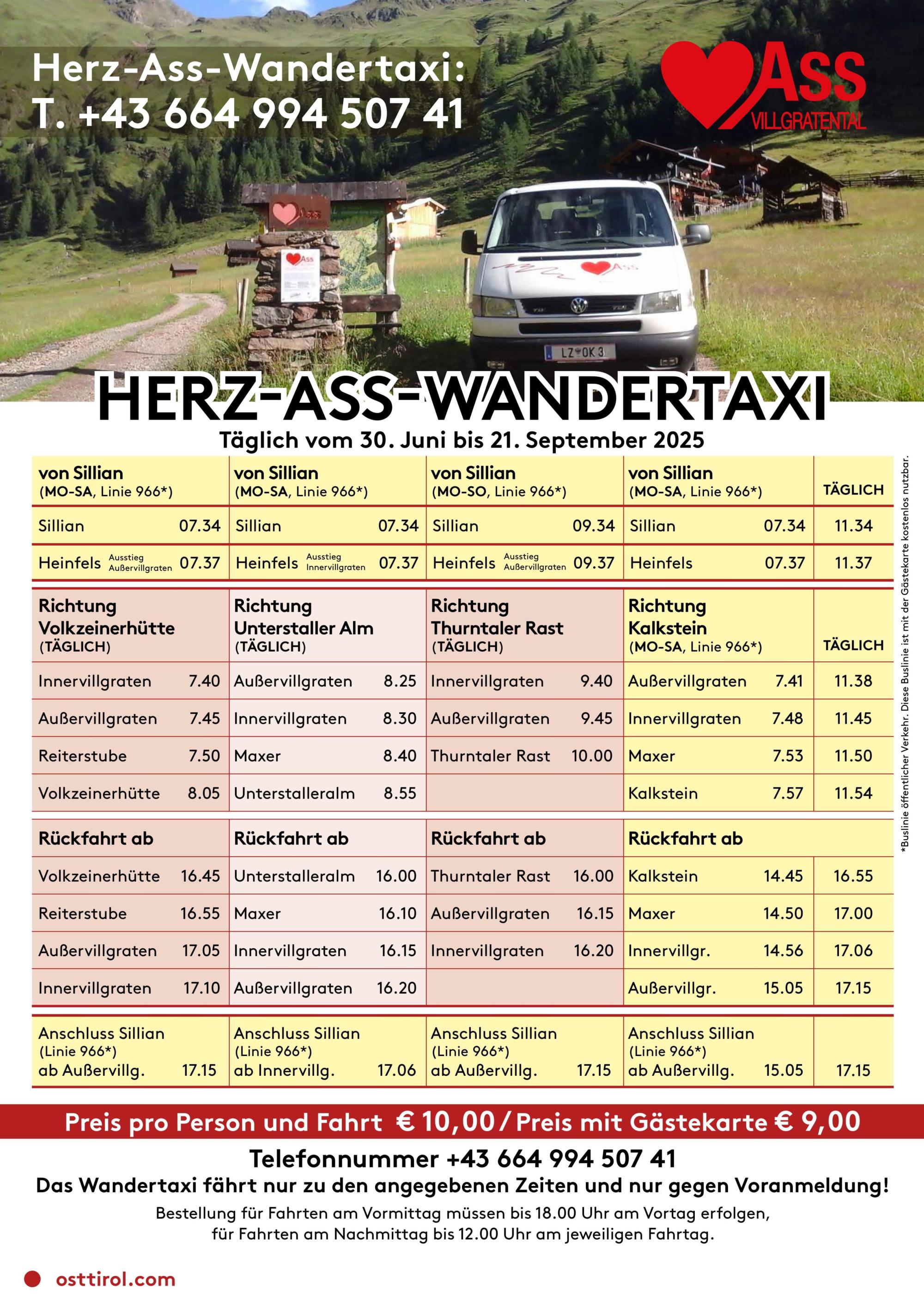
From Innervillgraten to the Reiterstube in Winkeltal (Außervillgraten)
Walking time approx. 4 hours - moderate hike
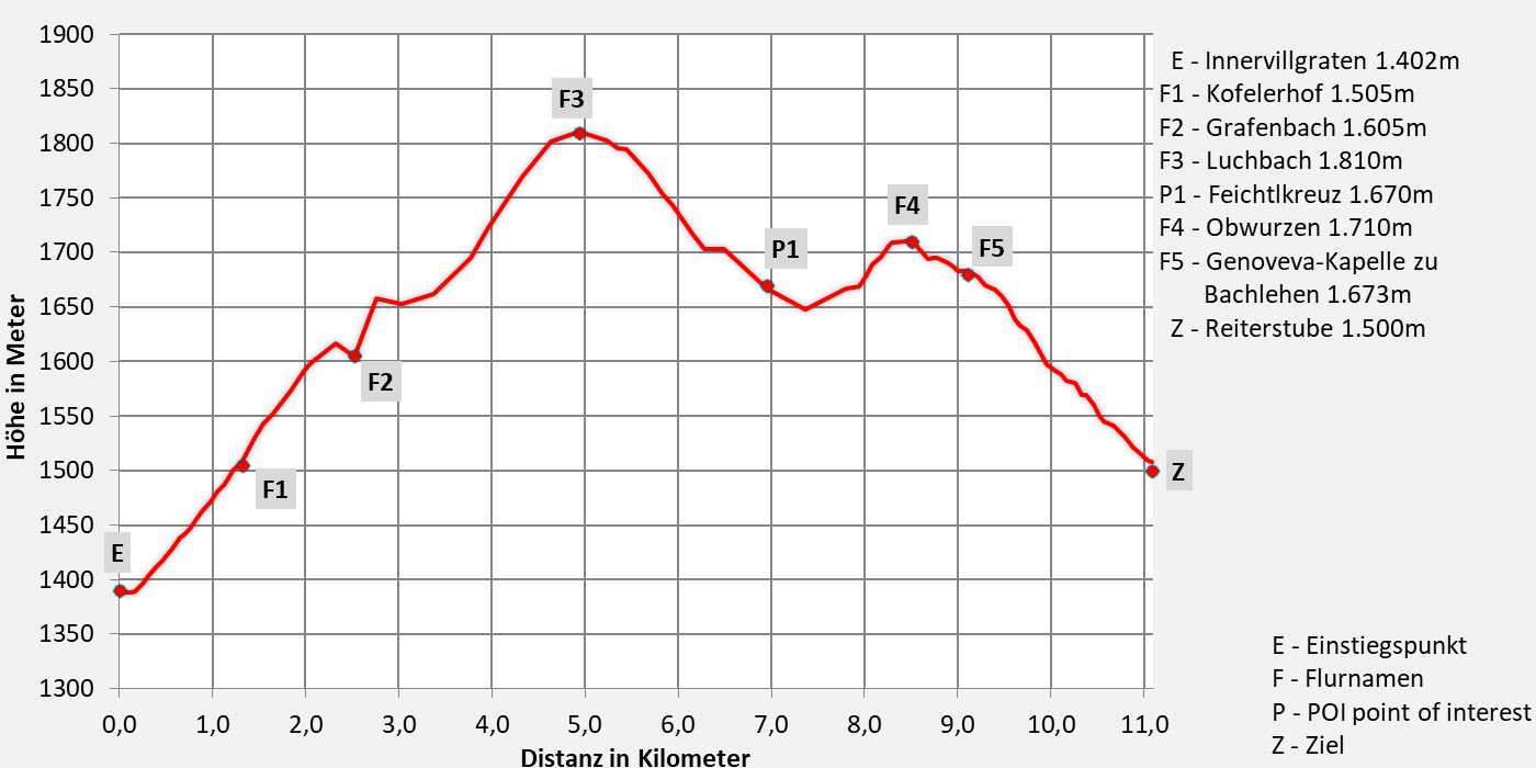
- 11,1km walking distance
- 510 ascent altitude
- 1130 descent altitude
- lowest point: 1.402m - Innervillgraten (start)
- highest point: 1.810m - Luchbach
Upper Trail of the Herz-Ass Villgratental - Hiking Trail via Ahornberg and Versellerberg Trail No. 30
From the center of Innervillgraten (1,402 m) (car park), past the Raiffeisen Inn, over the Einetbach bridge, then along the paved road to the first junction, then uphill to the Kofelerhof (1,505 m). From there, take the Ahornberg forest path to the Grafenbach (1,630 m). A short stretch follows a narrow forest path, then another forest path, past beautiful meadows, and then uphill to the highest point of the hike where you cross the Luchbach (1,820 m). From here, descend to the Feichtlkreuz (1,680 m), then continue flatly over the Versellerberg to the paved road. From here, climb again, passing Oberwurzen (1,710 m) and the Genoveva Chapel at Bachlehen (1,673 m). Finally, descend into the Winkeltal valley to the Reiterstube (1,500 m) in Außervillgraten.
What makes this trail special are the beautiful viewpoints overlooking the two villages of Innervillgraten and Außervillgraten. The route can also be hiked in the opposite direction from the Reiterstube.
Download:


Tourismusinformation Villgratental
+43 50 212 340
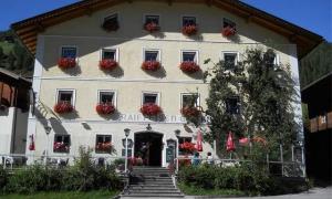
Gasthof Raiffeisen
+43 4843 5318
Übernachtung: ja
Gasthof Bachmann
+43 4843 5307
01.06.2025 - 20.10.2025
12.00 - 13.30 & 17.30 - 20.00 Uhr
Übernachtung: ja
Alfonsstüberl
+43.4843.5319
Übernachtung: ja

Gannerhof
+43 4843 5240
Übernachtung: ja

Jausenstation Reiterstube
+43 (0)4843 / 5188
im Juni Montags Ruhetag
ab Juli durchgehend geöffnet
12:00 - 19:00 Uhr
keine Übernachtungsmöglichkeit